Liberal University of Oregon


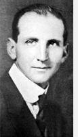
June Drake and Silver Creek Falls
(From Oregon Magazine, Silverton Number - 1929)
Tumbling Cascades Still Unknown to Many Who Think the South Falls Are Sole Attraction.
 Editors Note: June D. Drake's photography documenting the spectacular Silver Creek Falls was an important element in establishing a state park, but he also created publications advertising the beauty of the area and built signs in the area. His work was instrumental in protecting the Silver Creek Falls area from logging and convincing legislators to create a state park, on April 2, 1931.
Silver Creek Falls have been pictured in words and stories, but far too few people realize the extent of this wonderful series of tumbling, rolling, roaring beauties embraced in the group, which comprise ten falls instead of one or two, as many seem to think. A great number, in fact, are unacquainted with ^any other than one, mainly the South Falls.
There are ten falls in all thai: comprise the Silver Creek Falls group which are to be found within a three mile radius on both the North and South fork of Silver Creek, fifteen miles southeast ofSilverton. They are reached by leaving the Pacific highway either at Salem or Woodburn.
Drive to Silverton on paved road, then south on Water street past the Fischer Flouring mills, keeping the main traveled road, which winds along Silver Creek and up through the beautiful Silverton hills to the North Fork of Silver Creek, where there is parking space on either side of the bridge for a limited number of cars.
The Upper North Falls, which is 65 feet high, is to be reached by going up the south side of the stream where a good path is to be found although a little wet and muddy at times. This falls is three - fourths of a mile above the bridge and is worth the trip.
The main North Falls, which are 146 feet high, are one of the three finest of the entire group. They are down stream about 150 yards below the bridge and reached by following the path on the south side of the stream. Do not fail to go down under these falls, as you will be amply repaid and will marvel at nature. This falls is of a peculiar formation unlike any of the others in the group. The water falls from the center of an overhanging arch, striking on the point of a huge rock 146 feet below, where myriads of rainbows are to be seen on a bright day. The spacious gallery which is about halfway down under the arch of this falls will accommodate hundreds of people. There are places where the floor of this huge cave is covered with deep dust twelve months in the year.
After having spent a few hours at the North Falls continue west with your auto through the woods and open plains on a narrow winding dirt road for 1.4 miles to a tiny stream called Dry Creek. Park your car on the right side of the road, walk over a few feet, and you will see Dry Creek Falls, 198 feet high, which drop into the North Fork canyon. This is the highest of the Silver Creek Falls group. In the latter part of summer the water is so low that it is wasted away in spray before reaching the bottom. Drive another 1% miles to Silver City. Cross the bridge on the South Fork where you will find an auto park and camp grounds at the right.
To reach the South Falls from here follow the main path through the park across the foot bridge and on over to the falls, which is 184 feet high. More people have visited this falls than any of the others of the group. Be sure to go down underneath this falls where you will find large caves that lead off from the path which is about half way down under the cliff. This is rather steep and hard going, but if you do not make the descent you will not see the beauty and grandeur of this falls, the finest of the group.
The Lower South Falls, which are 100 feet high, are reached by going down stream, keeping to the right, following the trail along the edge of rim rock along the canyon; do not follow the creek bed.
This falls is a good mile down stream and a long steep descent from the canyon top. If you visit this falls do not take any extra wraps.
A visit to these five falls makes a nice day's trip with plenty of exercise, good fresh air and fishing for those who care although the fishing is considerably overdone. You can return home by continuing west, through the Union Hill district, via Shaw to Salem or keep to the right and return through the Waldo Hills via Silverton, which makes a loop trip.
I would not attempt to write an article telling the general public how to visit the other five falls, as the trails are grown up in places with brush and small firs and a stranger could easily get lost. I have had the pleasure of taking a number of parties into the canyon to see them. They are all five quite close together on the North Fork and are worth visiting.
The Silver Creek Falls differ from the falls along the Columbia River in that one doesn't know what to expect until he is at the canyon's edge peering over at them. There are three that you can go back of near the middle and keep dry in case of a rainy day.
I had the pleasure of taking Colonel Thompson, Superintendent of Crater Lake National Park, to visit all ten of this group of falls and he made the remark that he had visited a number of places and parks in both the old and the new worlds and never did he see a place where such a group of water falls were so close together, all different and interesting. He was also quite favorably impressed with the movement on foot to create a National Park in the Silver Creek Falls district.
Two bills are now before Congress, asking that the Government create a National Park including these ten falls.
My advice to parties visiting these falls, to see them right, is to dress in hiking clothes, wearing good heavy shoes. You will surely like this trip if you are a nature lover.
Text and image courtesy the Estell family.